 |
 |
 |
 |
Rio Belepeit 

Description:
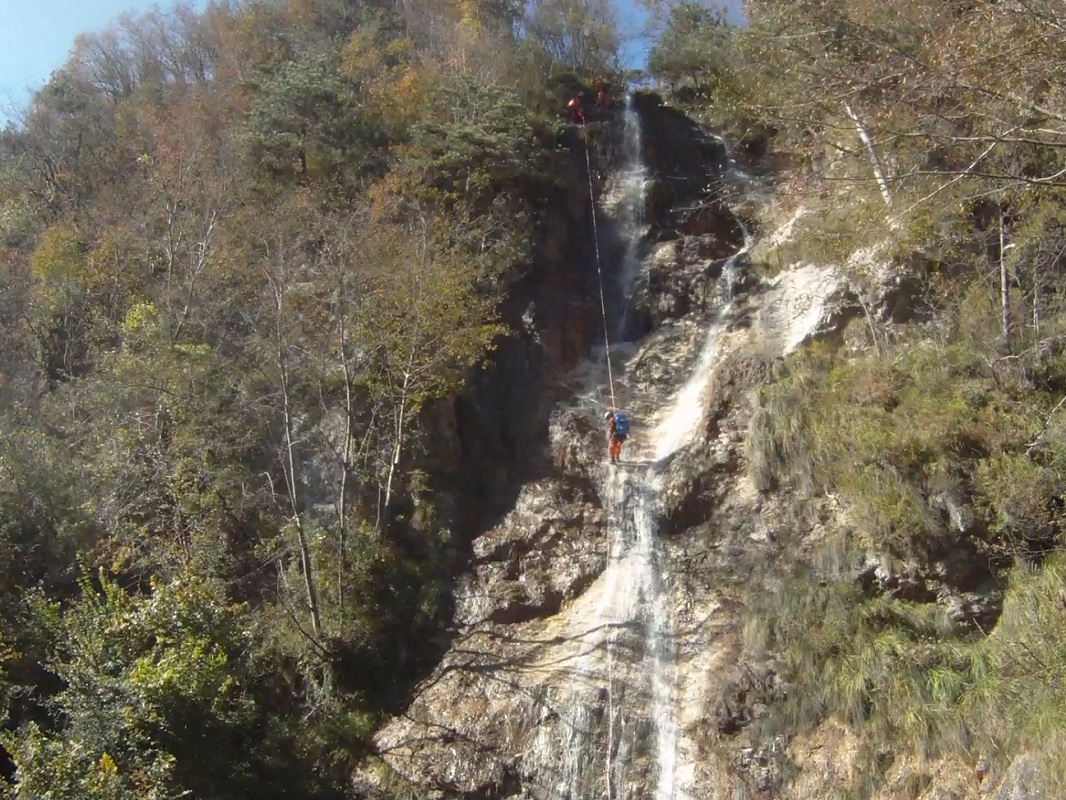
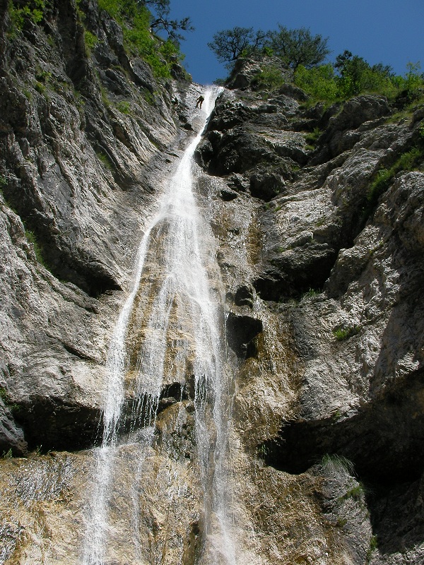
A short canyon that overlooks the town of Chiusaforte, whose focal point of interest is the large waterfall of 70 metres, clearly visible from the road below.
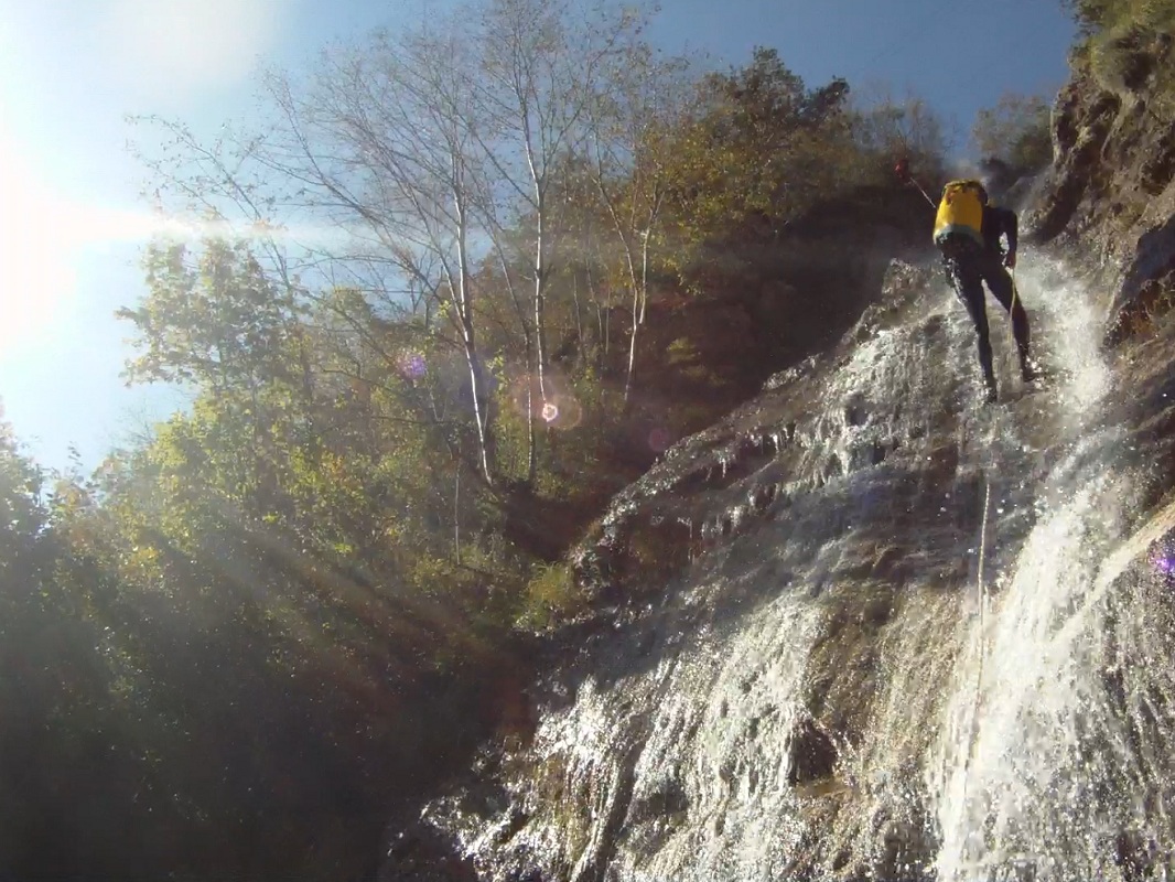
Descent of this canyon remains possible even when other routes are not possible due to excessive flow, and its decent is only recommend in the presence of flowing water.
Rio Belepeit can be connected with the nearby Rio del Mulin.
Zone:
Friuli Venezia Giulia - Chiusaforte (UD)Elevation and length:
Entrance: 580 mExit: 365 m
Height difference: 215 m
Length: 250 m
Highest pitch: 70 m
Advised decent period:
From May to October (best to descend after rainfall giving flow in the canyon)Exposure:
SouthTimings:
Approach: 40 minsDescent: 2h
Return: 5 mins
Shuttle:
1 KmAnchors:
Excellent ProCanyonAdvised ropes:
2 of 80 m + emergency ropeGear:
Complete wetsuitEscapes:
Before the last pitch, where there are some manmade structures, there is a path on the left that allows an easy exitMap:
Carta Tabacco 1:25000 foglio n° 018 - Alpi Carniche Orientali Canal del FerroInterest:
LocalDifficulty:
V4 a2 IICoordinates (WGS84) for downstream (valley) parking:
46° 24' 17,6" N 13° 17' 39,5" ECoordinates (WGS84) of the riverbed access point (start of canyon):
46° 24' 22,9" N 13° 17' 22,8" EApproach to the valley (lower car park):
Drive along SS 13 towards Tarvisio. Near Chiusaforte (Villanova) leave the car in the obvious parking on the right, from where you can see the highest waterfall
of the canyon.Approach to the mountain (upper car park):
Resume the main road towards Tarvisio. Take the first street on the left and enter the town of Chiusaforte.Follow this street until you reach a small square
with a fountain where you park.Approach to the canyon (walking):
Follow the path n° 425 between the houses. After approximately 30 mins walking, cross over a stream that is part of the canyon
Rio del Mulin.At an altitude of approximately 580 m, the path crosses a second stream that is the Rio Belepeit, from where you start the canyon.
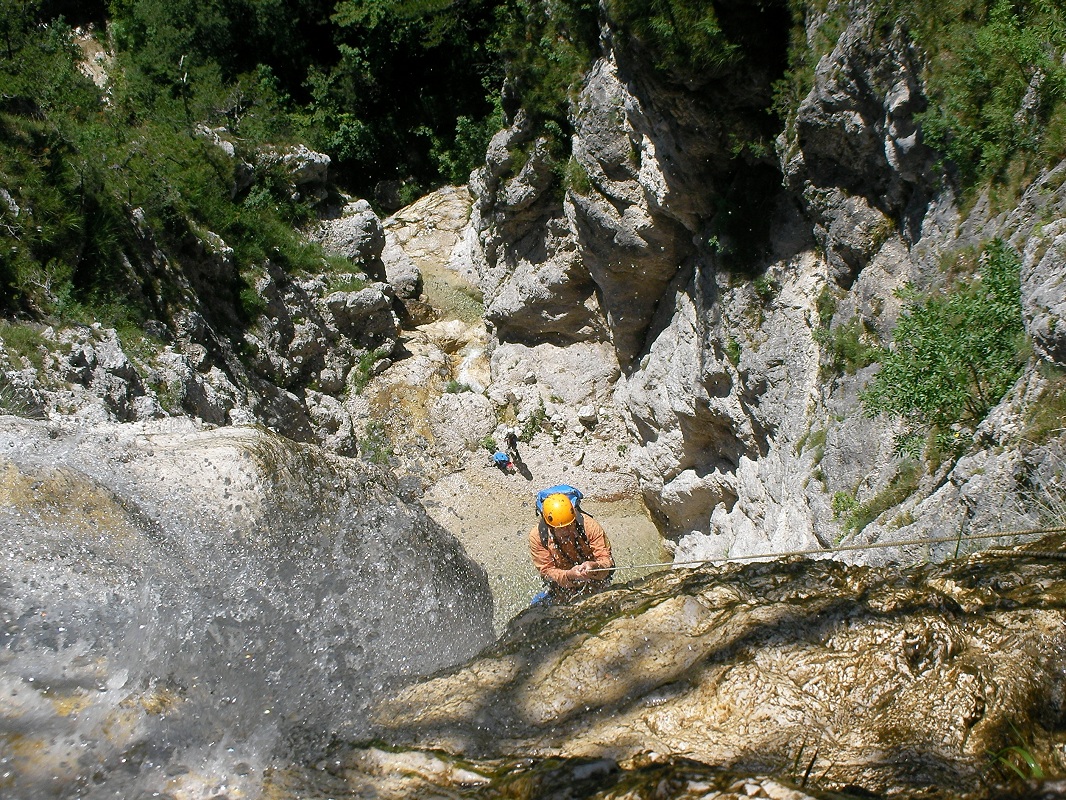
Description and technical notes:
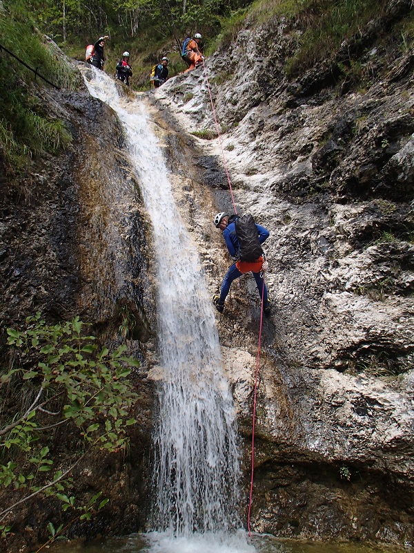
The first pitch is from a tree and is the start of a series of pitches01 - AN 6 L
02 - MC + P 12 L
03 - MC + P 75 R
04 - P 12 L
05 - MC + RB + P 35 R
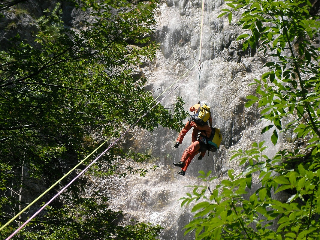
There are 3 fix anchors of 10 mm diameter above the anchor point, which are the attachment point of the upper part of the tyrolienne - at the base of the pitch on boulders in the middle of the stream there are two bolts in resin that are the lower attachment points of the tyrolienne
There is a possible escape route to the left
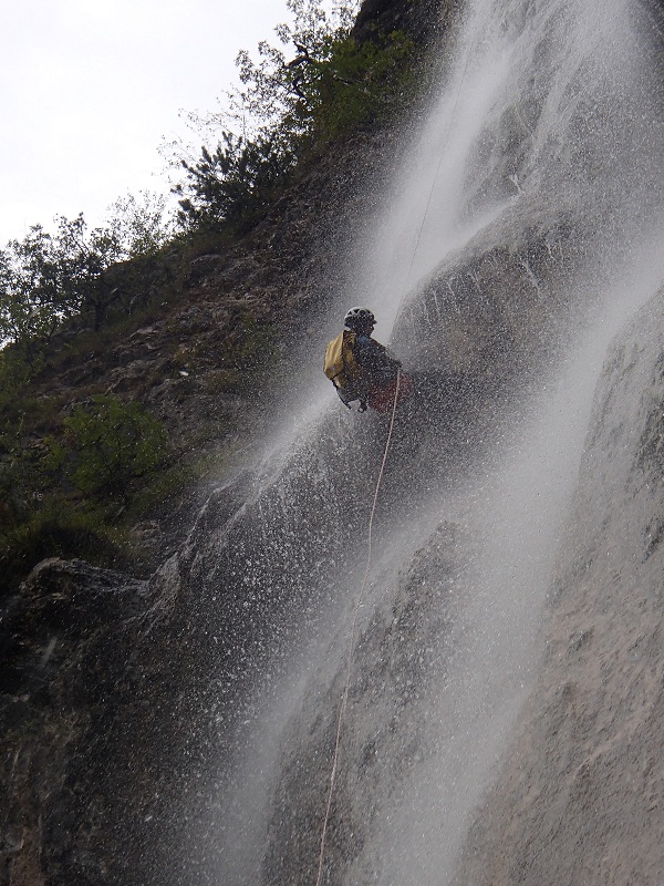
06 - P 7 R (lower right below rock step)
07 - P 40 R
Exit:
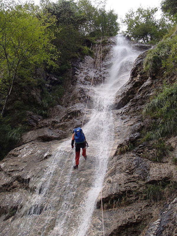
From the base of the last pitch, climb over the fence on the right bank to reach a path that passes through the village of Villanova, leading to the main road.
Continue on to the car park.Notes:
The anchors of pitch #06 are located on the right-hand side at the bottom of a rock step, allowing access to the 40 m pitch-head.It is possible connect this canyon with the nearby Rio del Mulin.
The first descent was on the 06/08/04 by Maurizio Biondi, Rosemarie Siegl, Giovanni Pizzorni, Matteo Centemero, Roberto Recchioni and Jean Claude Vaternel.
URL:http://www.canyoneast.it
Layout, design & revisions © 2017, CanyonEast Canyoning Team - Seba Broili, Vanessa Johnston, Romy Siegl, Cristian Vogrig
Webmaster: uomonero@canyoneast.it - Revised - - 22/08/2017
Layout, design & revisions © 2017, CanyonEast Canyoning Team - Seba Broili, Vanessa Johnston, Romy Siegl, Cristian Vogrig
Webmaster: uomonero@canyoneast.it - Revised - - 22/08/2017


